
Examples and Current Projects

Land Registry Compliant Plans
We can assist you in creating clear digital Land Registry Compliant plans.
Whether your current Title Deeds plans are changing because you are selling off part of your estate, or if you need to define a boundary on the ground that is present on a Title plan, we can probably help.
We have helped many clients who have needed to divide some land and then fence that land to exact measurements. The digital and printed versions of the 'red' line bounded plans will then be scaled exactly to match what is on the ground, conversely, an exact area taken from a title plan can be marked-out onto the ground to accurately reflect the parcel to be transferred.
This applies to both linear distance boundaries and exact areas in acres, hectares etc.
Please drop us a line on the Contact page.
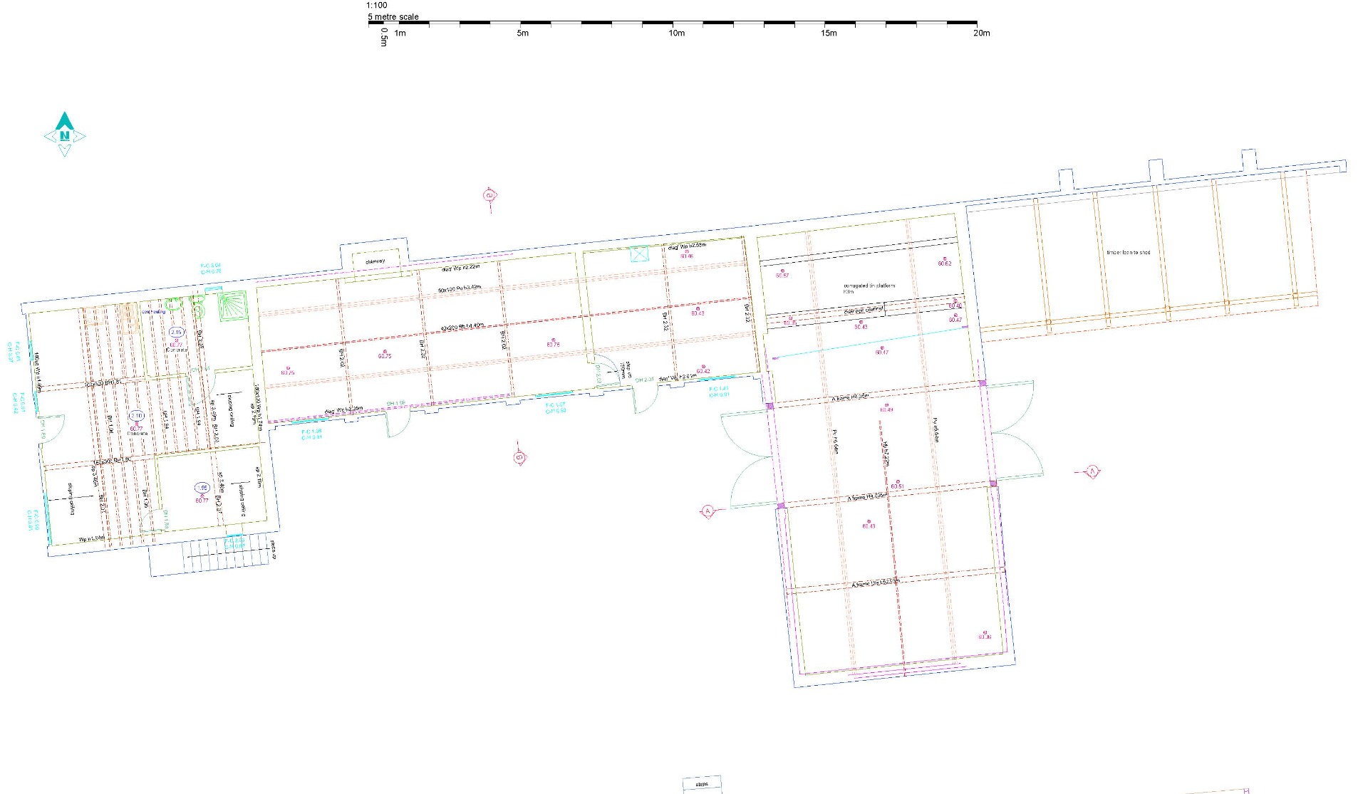
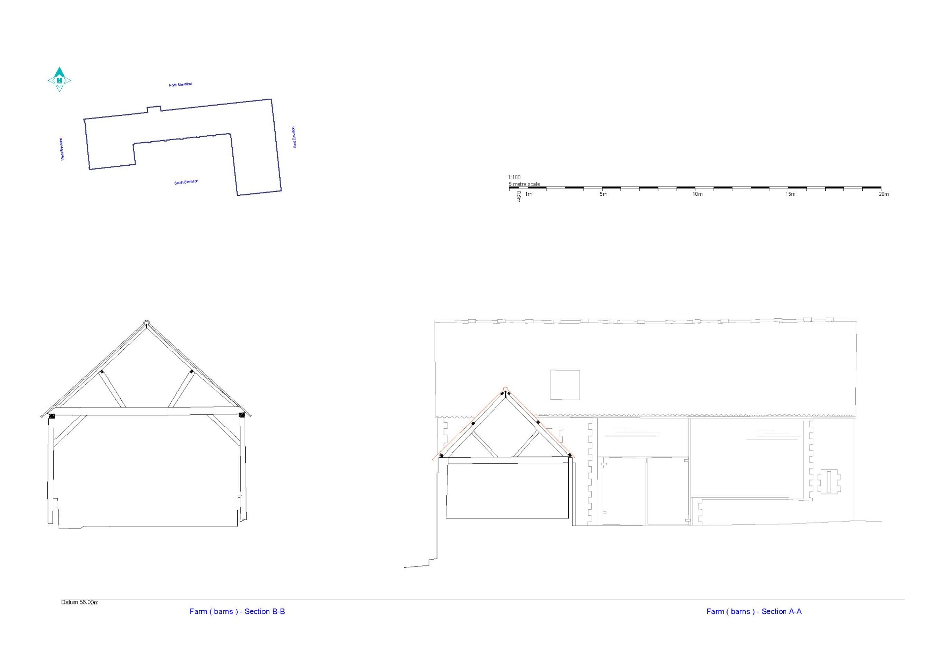
Recording of a Grade 2 listed barn
A request for a topographic survey along with plans, elevations and section drawings for a Grade 2 listed barn.
The survey CAD drawings enabled the architect to take these files, manipulate them and use in support of other documentation for the purpose of planning consent at varying scales to present their case in collaboration with the client.


Victorian Mansion
The brief was to provide an extensive set of digital cad drawings for a previously derelict mansion and the grounds in which it sat.
Thoroughly challenging for a host of reasons but we turned it around in good time.
We also provided a set of aerial photos along with video footage using our CAA registered drone.